Plan this trip with us. $250 planning fee, credited in full toward your trip. The fee funds your property briefing.
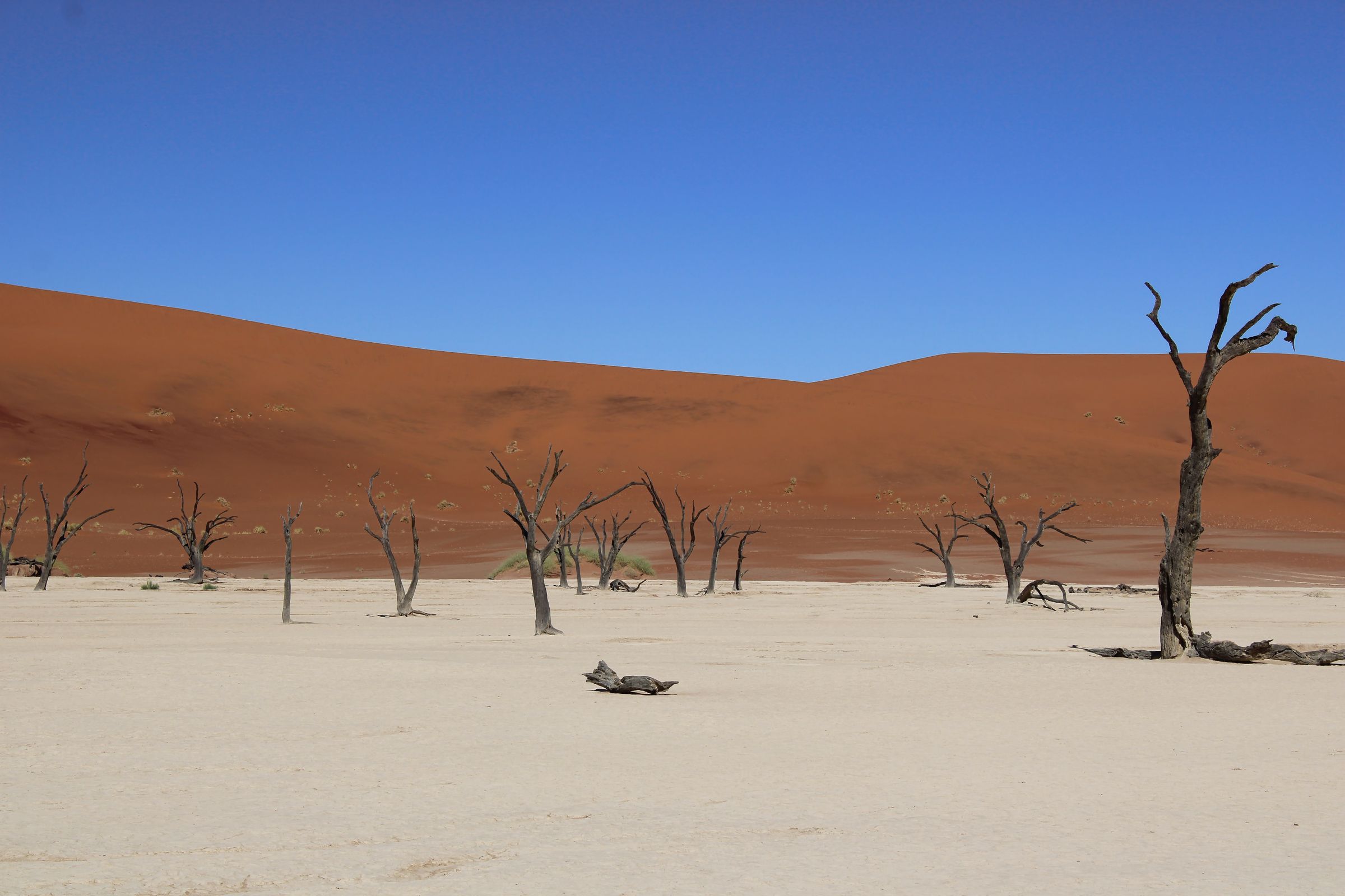
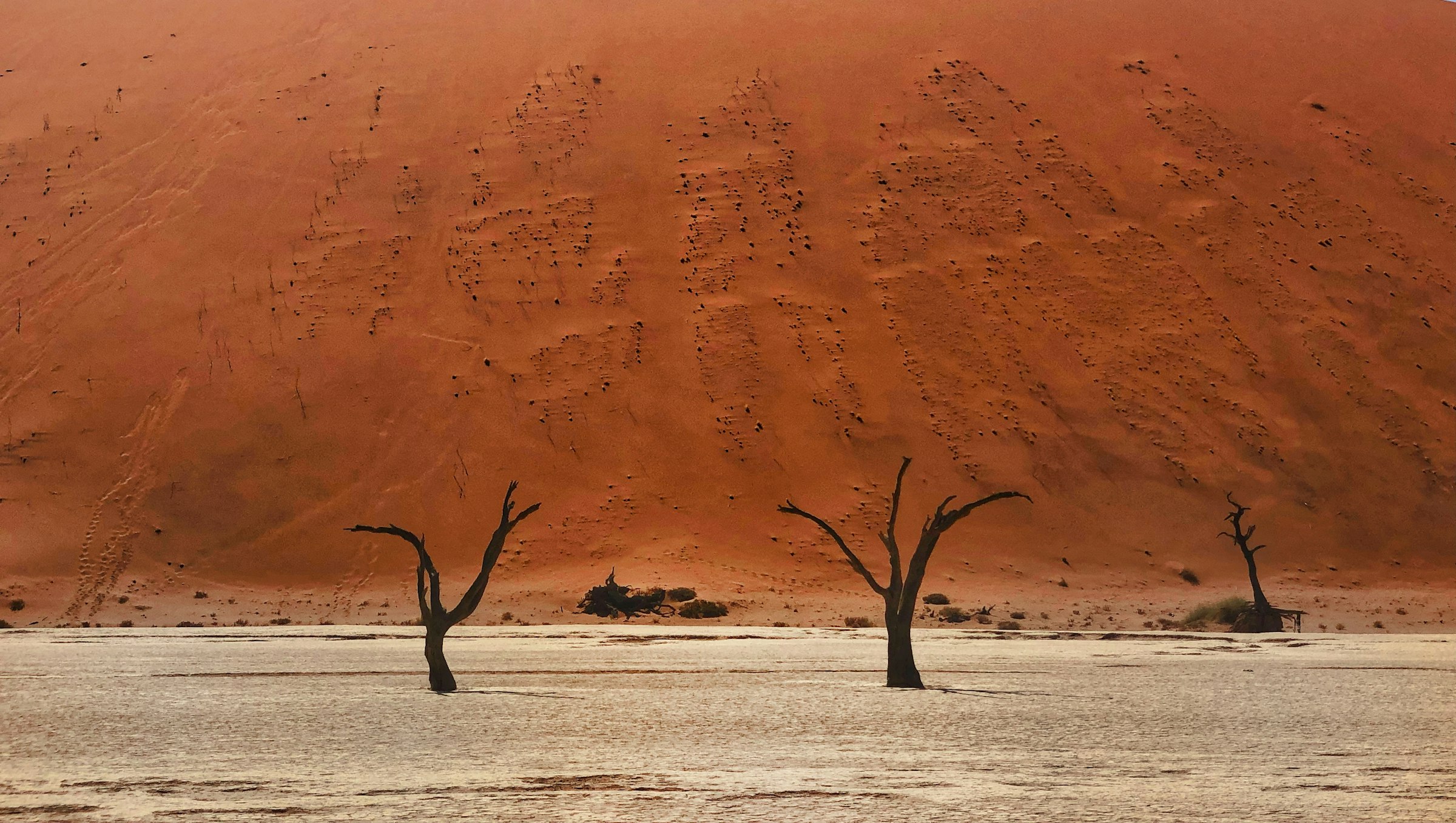
Start the inquiryNamibia is the desert safari. The Namib runs the length of the Atlantic coast, and inside it are the red dunes of Sossusvlei, some of the highest in the world, and the white clay pan of Deadvlei with its dead camelthorn trees. North of the dunes the Skeleton Coast is fog, shipwrecks and a huge Cape fur seal colony at Cape Cross, and inland from it Damaraland is dry riverbeds, rock engravings and the desert-adapted elephants and black rhino that live along them. In the north, Etosha is a salt pan the size of a small country, with waterholes where the game comes to you.
The country is big and empty, and that shapes the trip. Distances between the regions are long, so most luxury itineraries fly between camps by light aircraft, with Windhoek as the gateway, and a typical route is the dunes, then Damaraland or the Skeleton Coast, then Etosha. Self-drive on good gravel roads is the other way to see it, and it suits people with more time who want the road itself to be part of the trip.
The south and the coast are malaria-free, the wildlife is spread out rather than concentrated, and the scenery is the point. It pairs well with Botswana or Cape Town, both a short flight from Windhoek.
Best for: photographers and people who want scenery first, second or third safaris, families who want to avoid malaria, and anyone who likes the idea of a week with almost nobody else in it.
A good Namibia trip comes down to routing. The regions are far apart, the best camps sit inside or beside private reserves rather than in the national parks, and whether you fly or drive changes the trip more than it does anywhere else in southern Africa. I help you choose fly-in or self-drive, the camps and rooms for each region, and the order you visit them in, book the camps, flights and local operators, and am your point of contact before and during the trip, including the luggage limits on the light aircraft, the park gate hours that decide whether you see the dunes at sunrise, and the long road days that catch people out.
I book through Fora, so I can often add perks through Fora Reserve and hotel brands’ own advisor programs, such as a property credit, a welcome amenity or an upgrade when one is free, at many properties where available.
Namibia is where the modern version of this was invented: communal conservancies, where the people who live with the wildlife hold the rights to benefit from it. There are more than 80 of them now. Damaraland's rhino tracking exists because the Torra Conservancy co-owns the camp and employs the trackers. When I say a Namibian itinerary supports conservation, this structure is what I mean.
Namibia wrote conservation into its constitution and then handed much of it to the people who live with the wildlife.
Namibia's history is written in rock, sand and a few unlikely towns, and most of it sits on the way between the safari regions.
Namibia has a long dry winter, a hot build-up, and a short, unreliable summer rain in the north.
Clear skies, cold nights and the best game viewing in Etosha, where the animals gather at the waterholes as the pans dry. The dunes are at their most comfortable. This is the busiest season, and the small camps fill early.
Temperatures climb, especially inland, and Etosha stays excellent until the first rains. Fewer visitors than mid-year, and the light over the dunes is dramatic before the afternoon heat.
Rain, when it comes, falls mostly in the north between January and March and turns Etosha and Damaraland green, with young animals and migrant birds. Game is harder to find as water spreads out. Sossusvlei and the coast are largely unaffected, and rates are lower.
For May–October, book by January.

The Fish River Canyon is the centrepiece of Namibia's deep south: often called the second-largest canyon in the world, best seen from the rim at sunrise or sunset. Around it, Lüderitz is a German port town on a wild coast, Kolmanskop is the diamond-boom ghost town slowly filling with sand, and the red dunes of the Kalahari begin to the east.
This is the add-on for longer trips, not the core circuit: a week of the classic route first, then the south if there is time and appetite for the road.
Researched profile: this page is written from our planning research and partner knowledge rather than a Wild Atlas stay — when that changes, this line comes off.

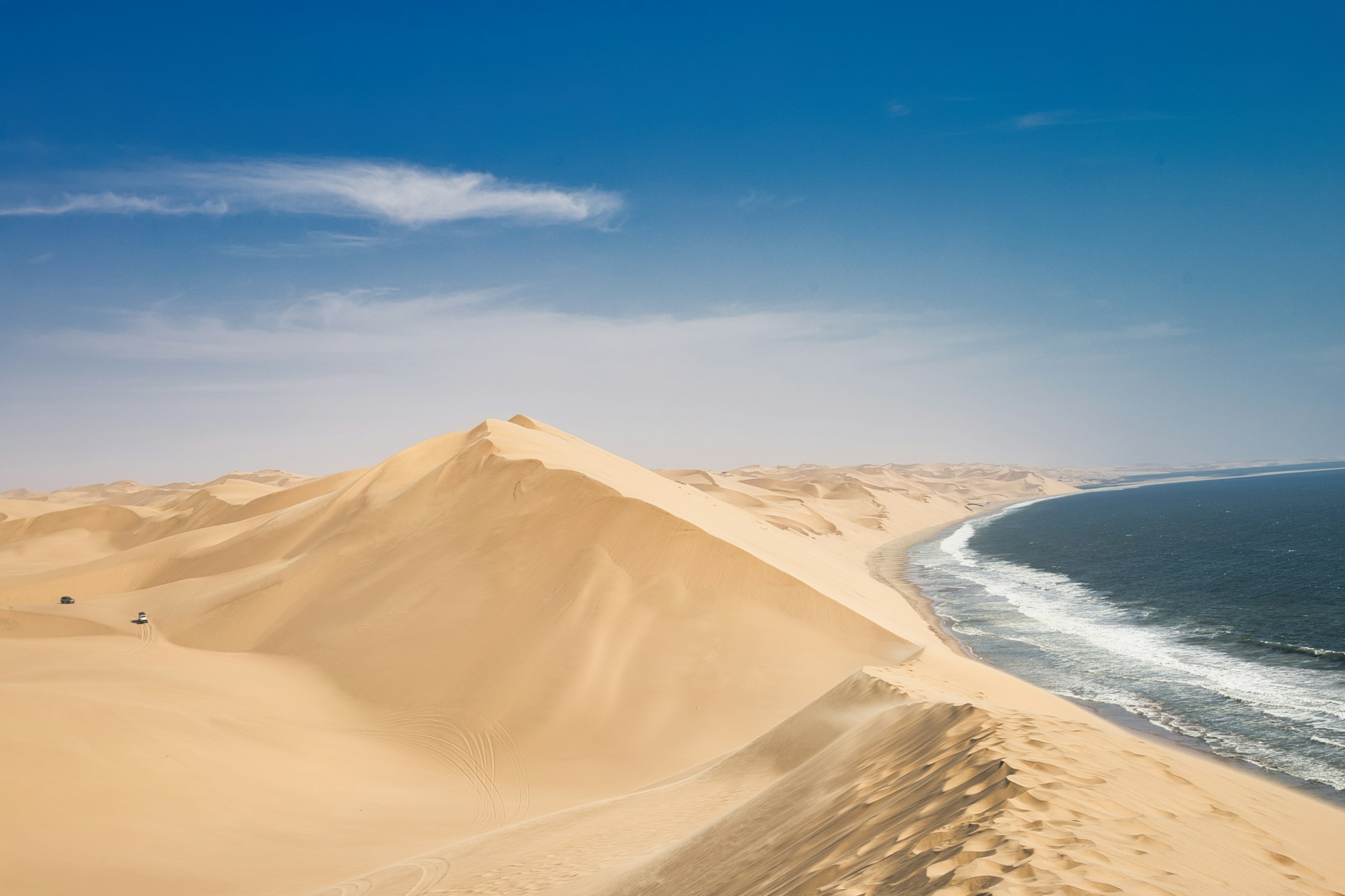
Swakopmund is the German colonial town on Namibia's Atlantic coast: half-timbered facades, a palm-lined promenade, cold sea and warm cake. It is the soft landing between the desert legs of a trip, and the base for Sandwich Harbour, where the dunes drop straight into the ocean, and Walvis Bay's lagoon of flamingos.
Two nights here is a change of temperature and pace, with the adventure sports on hand for the active days.
Researched profile: this page is written from our planning research and partner knowledge rather than a Wild Atlas stay — when that changes, this line comes off.
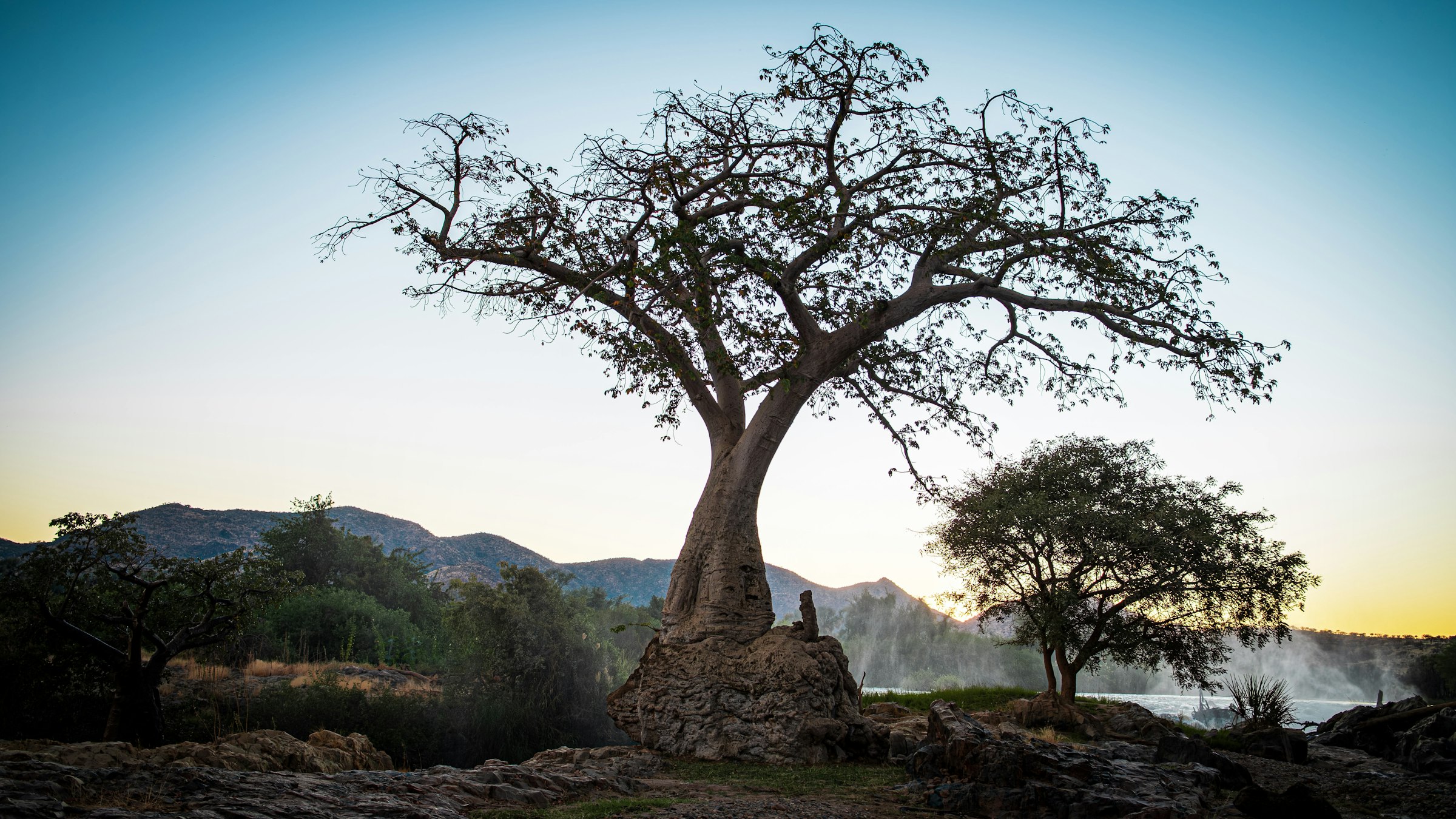
The Kunene is Namibia's emptiest corner: the far north-west, where the semi-nomadic Himba live in the Kaokoveld, the Kunene River forms the border with Angola, and Epupa Falls drops the river through a gorge of baobabs. It is the add-on for people who have done the classic circuit and want the end of the road.
Visits to Himba communities run through the camps' community partnerships; the region is fly-in or serious 4x4, and the distances are honest.
Researched profile: this page is written from our planning research and partner knowledge rather than a Wild Atlas stay — when that changes, this line comes off.
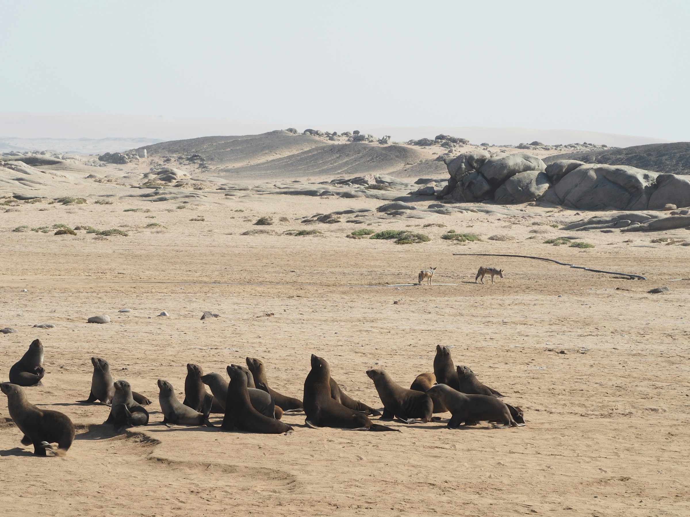
The Skeleton Coast is the Atlantic edge of the Namib north of Swakopmund: fog most mornings, shipwrecks and whale bones in the sand, a Cape fur seal colony at Cape Cross that runs to the tens of thousands, and dunes that end in surf. It is the strangest landscape in Namibia and, for the right traveller, the most memorable.
The northern park is fly-in only, from a handful of small camps; the Hoanib River behind the coast is where the desert elephant and lion come down to the sea.
Researched profile: this page is written from our planning research and partner knowledge rather than a Wild Atlas stay — when that changes, this line comes off.
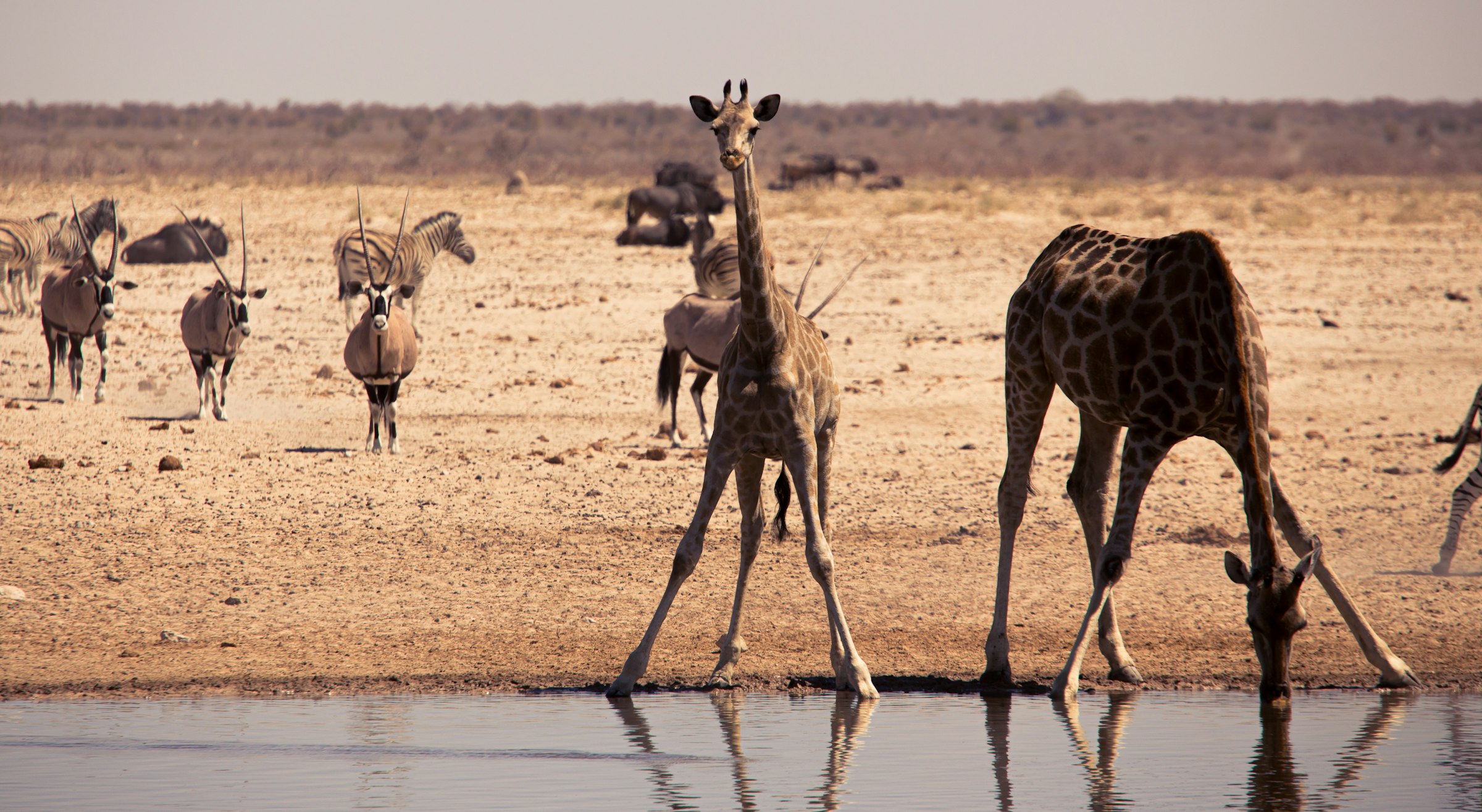
Etosha is Namibia's big-game region: a national park built around a salt pan the size of a small country, ringed by waterholes where, in the dry season, the animals come to you. It is the most conventional safari in Namibia and the one that delivers the big herds.
The strategy is two camps, one on a private reserve on the park boundary and one inside the park, so you get the quiet and the numbers.
Researched profile: this page is written from our planning research and partner knowledge rather than a Wild Atlas stay — when that changes, this line comes off.
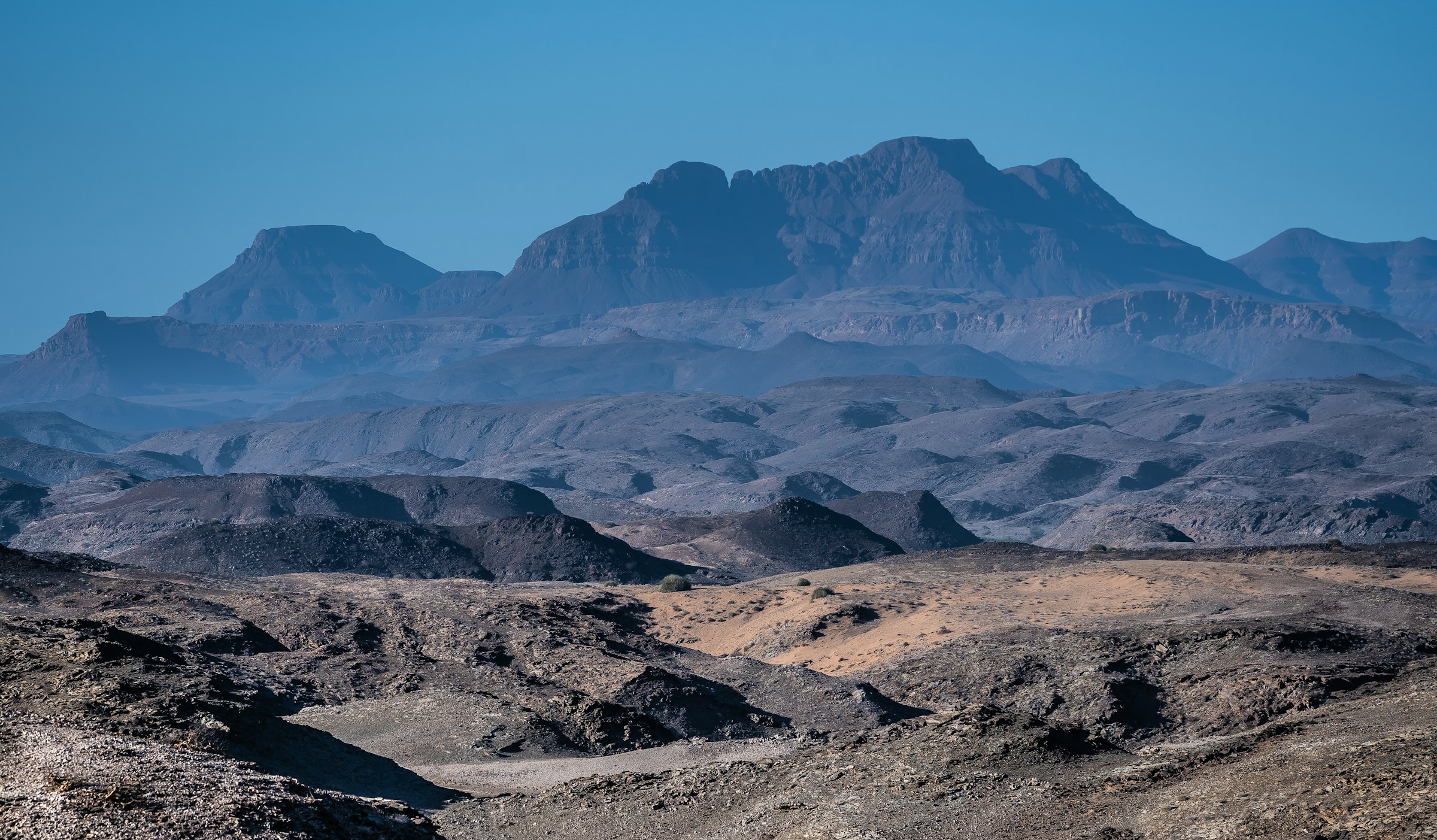
Damaraland is the rocky, red north-west of Namibia between the Namib and Etosha: dry riverbeds, flat-topped mountains, and the desert-adapted elephant and black rhino that live along them. It is the region that makes the country feel like a safari and not only a landscape.
It is also where Namibia's conservation model is clearest. Most of the best camps sit on communal conservancy land, with the community as a partner, and Save the Rhino Trust has monitored the rhino here since the early 1980s.
Researched profile: this page is written from our planning research and partner knowledge rather than a Wild Atlas stay — when that changes, this line comes off.
Sossusvlei is the Namibia everyone has seen a picture of: red dunes, some of the highest in the world, inside the Namib-Naukluft park, and next to them the white clay pan of Deadvlei with its dead camelthorn trees. It is scenery first, and it rewards being there at sunrise.
The trip here is about where you sleep. Inside the park gate or on the private reserves beside it, you are on the sand in the first hour of light; outside it, you join the queue.
Researched profile: this page is written from our planning research and partner knowledge rather than a Wild Atlas stay — when that changes, this line comes off.
Every trip begins with a 20-minute planning call. From there, a $250 planning fee, credited in full toward your booked trip and non-refundable if you don’t book. I brief the property before you arrive — that's what the fee funds. I reply within one business day.
Plan your trip